CANADA TO MEXICO ROUTE: 29 DAYS/1770 MILES/61,386' ELEVATION GAIN
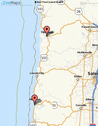
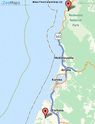
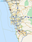
Vancouver, Canada to Astoria, Oregon
286 Miles/7,683' Elevation Gain Cycling solo August 14-19 |
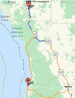
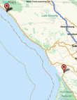
Day 0: Vancouver, Canada to Anacortes, WA
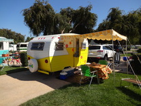
Cycling Distance: 4 Miles in Canada,; ferry to U.S. Cumulative Miles: 4 Elevation Gain: 0 Cumulative Elevation Gain: 0 Lodging: Ship Harbor Inn ($120.12 total) |
Day 0 Itinerary
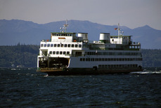
After an early flight from San Francisco to Vancouver, Canada., I'll take the SkyTrain Canada Line to Bridgeport station & change to the “No. 620 Tsawwassen Ferry” bus. I'm taking the ferry to Swartz Bay, then I jump on my bike & ride 4 miles to the Sidney ferry terminal, in time for the late ferry to Anacortes, Washington, USA. |
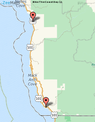
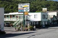
Day 1: Anacortes to Quilcene, WA
Cycling Distance: 71 Miles Cumulative Miles: 75 Miles Elevation Gain: 2,464' Cumulative Elevation Gain: 2,464' Lodging: Mount Walker Inn ($65 +tax) |
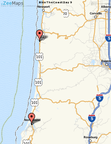
Day 1 Route Guide
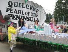
CycleTheCoast13 rolls 71 miles through Oak Harbor, on Whidbey Island, then on to Port Townsend via ferry. Today's ride finishes in Quilcene, home to the Quilcene oyster, on Quilcene Bay. |
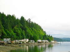
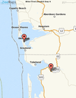
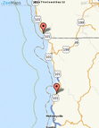
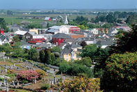
Day 2: Quilcene to Potlatch, WA
Cycling Distance: 40 Miles Cumulative Miles: 115 Miles Elevation Gain: 1,729' Cumulative Elevation Gain: 4,193' Lodging: Waterfront at Potlatch ($98.37 total) |
Day 2 Route Guide
Most of this today's ride skirts the edge of the Hood Canal. With few lodging options, I'm stuck at 40 miles so I booked a great waterside spot in Potlatch. |
Day 3: Potlatch to Westport, WA
Cycling Distance: 79 Miles Cumulative Miles: 194 Miles Elevation Gain: 1,6,73' Cumulative Elevation Gain: 5,866 Lodging: Westport Bayside B&B ($71.44 total) |
Day 3 Route Guide
Today's 80-miler heads west along the Chehalis River, to Aberdeen and on to the fishing town of Westport, situated on a peninsula between Gray's Harbor & the Pacific. |
Day 4: Westport to South Bend, WA
Cycling Distance: 38 Miles Cumulative Miles: 232 Miles Elevation Gain: 568' Cumulative Elevation Gain: 6,434' Lodging: Seaquest Motel ($50.00 + tax) |
Day 4 Route Guide
With the Pacific finally on my right, I'll pass through Grayland, then wrap around Willapa Bay to South Bend, known for its oysters & scenery. |
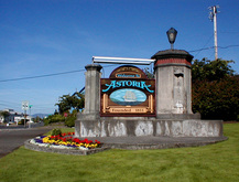
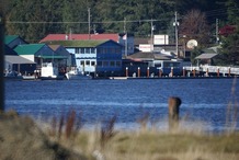
Day 5: South Bend to Astoria, OR
Cycling Distance: 53 Miles Cumulative Miles: 285 Miles Elevation Gain: 1,444' Cumulative Elevation Gain: 7,877' Lodging: Rose River Inn B&B ($85.00 total cash) |
Day 5 Route Guide
Most of today is along Willapa Bay before briefly turning inland through Naselle. I'll finish the day riding along the Columbia river & over the Astoria-Megler Bridge to Astoria. |
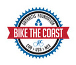
Astoria, Oregon to Brookings, Oregon
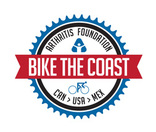
People's Coast Classic benefiting Arthritis Foundation 366 Miles/14,918' Elevation Gain September 8-13 |
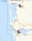
Day 6: Astoria to Tillamook, OR
Cycling Distance: 72 Miles Cumulative Miles: 357 Miles Elevation Gain: 2,730' Cumulative Elevation Gain: 10,607' Lodging: PCC Camp at Tillamook River RV Park |
Day 6 Route Guide
More civilization as I begin the PCC and ride through the towns of Seaside, Cannon Beach, and Manzanita, then around Nehalem Bay & finishing this 72-miler in the cheese town of Tillamook. |
Day 7: Tillamook to Newport, OR
Cycling Distance: 83 Miles Cumulative Miles: 440 Miles Elevation Gain: 3,963' Cumulative Elevation Gain: 14,570' Lodging: PCC Camp at Oregon Coast Aquarium |
Day 7 Route Guide
At 83 miles, this is the longest day in Oregon & Washington. Mostly traversing the coast, I'll cycle through Lincoln City, finishing at the Oregon Coast Aquarium in Newport.. |
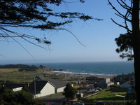
Day 8: Newport to Yachats, OR
Cycling Distance: 23 Miles Cumulative Miles: 462 Miles Elevation Gain: 430' Cumulative Elevation Gain: 15,001' Lodging: PCC Camp at Yachats Community Park |
Day 8 Route Guide
The shortest day of my ride follows one of the longest with this 23-miler down the coast to Yachats, a frequent choice amongst Top 10 travel destination in the World. |
Day 9: Yachats to North Bend, OR
Cycling Distance: 73 Miles Cumulative Miles: 536 Miles Elevation Gain: 3,018' Cumulative Elevation Gain: 18,019' Lodging: PCC Camp at Clyde Allen Baseball Park |
Day 9 Route Guide
Lots of up & down as the route skirts the dunes through Florence & Reedsport, past several lakes & over Umpqua River to North Bend, situated on Coos Bay. |
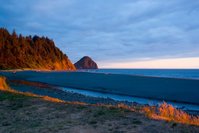
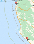
Day 10: North Bend to Arizona Beach, OR
Cycling Distance: 69 Miles Cumulative Miles: 605 Miles Elevation Gain: 2,349' Cumulative Elevation Gain: 20,368' Lodging: PCC Camp at Arizona Beach Rec Site |
Day 10 Route Guide
Today's route is off the coast a bit until the town of Bandon, famous for golf & cranberries. The route then moves inland again until Port Orford, then coastal to Arizona Beach. |
Day 11: Arizona Beach to Brookings, OR
Cycling Distance: 46 Miles Cumulative Miles: 651 Miles Elevation Gain: 2,428' Cumulative Elevation Gain: 22,795' Lodging: PCC Wild Rivers Motor Lodge ($60) |
Day 11 Route Guide
I hug the coast today, rolling over the Rogue River and into Gold Beach. No other towns to speak of before Brookings, the biggest town since Astoria, and my last stop before California. |

Brookings, Oregon to San Francisco, CA
446 Miles/18,730' Elevation Gain Cycling solo September 14-21 |
Day 12: Brookings, OR to Orick, CA
Cycling Distance: 71 Miles Cumulative Miles: 721 Miles Elevation Gain: 2,956' Cumulative Elevation Gain: 25,751' Lodging: Palm Café & Motel ($60 + tax) |
Day 12 Route Guide
Once in California, I wrap around Pelican Bay and through Crescent City. Then it's into the Redwoods before returning to the coast north of the Klamath River. Orick, known for it's burl art is my stop for the night. |
Day 13: Orick to Ferndale, CA
Cycling Distance: 68 Miles Cumulative Miles: 789 Miles Elevation Gain: 1,906' Cumulative Elevation Gain: 27,658' Lodging: Redwood Suites ($82.50 total) |
Day 13 Route Guide
Coastal redwoods begin the day before rolling through McKinleyville, Arcata & Eureka. I detour off 101 to the Victorian village of Ferndale the gateway to California's Lost Coast. |
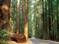
Day 14: Ferndale to Garberville, CA
Cycling Distance: 60 Miles Cumulative Miles: 849 Miles Elevation Gain: 2,723' Cumulative Elevation Gain: 30,381' Lodging: Best Western Humboldt House Inn ($99) Benbow Inn (rest day: $50) |
Day 14 Route Guide
Back on 101, I hug the Eel River until turning off on Avenue of the Giants and through the redwoods, all the way to Garberville, where I'll enjoy an extra rest day at the historic Benbow Inn. |
Day 15: Garberville to Ft. Bragg, CA
Cycling Distance: 70 Miles Cumulative Miles: 918 Miles Elevation Gain: 4,206' Cumulative Elevation Gain: 34,587' Lodging: Columbi Motel ($55.50 + tax) |
Day 15 Route Guide
I'll spend 2/3 of Day 15 working my way back to the coast. No towns to stop in before Westport (pop. 60) at mile 53. From there it's 20 miles to Ft. Bragg, gateway to the Mendocino Coast. |
Day 16: Ft. Bragg to Gualala, CA
Cycling Distance: 60 Miles Cumulative Miles: 979 Miles Elevation Gain: 2,323' Cumulative Elevation Gain: 36,910' Lodging: Gualala Country Inn ($74.93 total) |
Day 16 Route Guide
Glorious view of the Pacific will be off my right shoulder all day. I pass through artsy Mendocino at mile 9 and then quiet roads until stopping in the tourist village of Gualala., |
Day 17: Gualala to Tomales, CA
Cycling Distance: 64 Miles Cumulative Miles: 1,042 Miles Elevation Gain: 2,641' Cumulative Elevation Gain: 39,551' Lodging: The Continental Inn ($120 + tax) |
Day 17 Route Guide
Another great day hugging the unspoiled coast. I ride through Jenner and over the Russian River, then turn inland at Bodega Bay through Valley Ford and into the historic village of Tomales. |
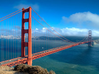
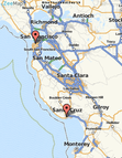
Day 18: Tomales to San Francisco, CA
Cycling Distance: 53 Miles Cumulative Miles: 1,096 Miles Elevation Gain: 1,975' Cumulative Elevation Gain: 41,526' Lodging: Home - Los Gatos, CA |
Day 18 Route Guide
After 17 days of quiet villages & unspoiled scenery, it's back to civilization after first riding along Tomales Bay, leaving Hwy 1 at Pt. Reyes Station. Fairfax, Larkspur, Corte Madera, Sausalito, then the GG Bridge into "The City". |

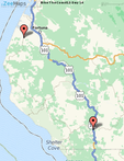
San Francisco, CA to Manhattan Beach, CA
California Coast Classic benefiting Arthritis Foundation 520 Miles/17,086' Elevation Gain September 28 - October 5 |
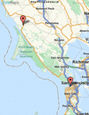
Day 19: San Francisco to Santa Cruz, CA
Cycling Distance: 78 Miles Cumulative Miles: 1,174 Miles Elevation Gain: 2,703' Cumulative Elevation Gain: 44,231' Lodging: CCC Camp at Santa Cruz High School |
Day 19 Route Guide
Today begins 8 days of cycling I've done 5 times before. SF is great but in short order I'm yearning for Pacifica, Half Moon Bay and Davenport, the coastal communities that take me to Surf City, USA, Santa Cruz. |
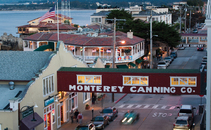
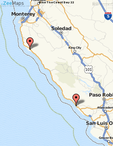
Day 20: Santa Cruz to Monterey, CA
Cycling Distance: 48 Miles Cumulative Miles: 1,222 Miles Elevation Gain: 1,243' Cumulative Elevation Gain: 45,474' Lodging: CCC Camp at Veteran's Memorial Park |
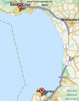
Day 20 Route Guide
Circling Monterey Bay, I'll be cycling through Capitola, Aptos and the strawberry fields of Watsonville. Short day makes for a long lunch on Cannery Row in Monterey. |
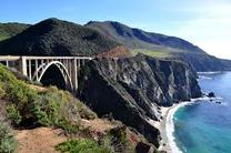
Day 21: Monterey to Big Sur, CA
Cycling Distance: 45 Miles Cumulative Miles: 1,267 Miles Elevation Gain: 1,627' Cumulative Elevation Gain: 47,101' Lodging: CCC Camp at Pfeiffer Big Sur |
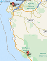
Day 21 Route Guide
Day starts with awesome golf-course studded shorelines in Pacific Grove and Carmel. The miles cycling along 17-Mile Drive melt away and then a short climb to Pfeiffer Big Sur State Park. |

Day 22: Big Sur to Cambria, CA
Cycling Distance: 68 Miles Cumulative Miles: 1,335 Miles Elevation Gain: 4,521' Cumulative Elevation Gain: 51,622' Lodging: CCC Sleep at Mom's House |
Day 22 Route Guide
Biggest climbing day & some of the most spectacular scenery in the world. Rolling up & down the coastline until Ragged Point, the last 20 miles flatten out to mom's house in Cambria. |
Day 23: Cambria to Pismo Beach, CA
Cycling Distance: 59 Miles Cumulative Miles: 1,394 Miles Elevation Gain: 1,240' Cumulative Elevation Gain: 52,862' Lodging: CCC Camp at Oceano Dunes |
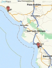
Day 23 Route Guide
Familiar territory through Cayucos, Morro Bay & lunch in SLO-town, San Luis Obispo. Windy out to coastal towns of Avila & Shell Beach. Check out the dune buggies & trucks on Pismo Beach. |
Day 24: Pismo Beach to Buelton, CA
Cycling Distance: 66 Miles Cumulative Miles: 1,459 Miles Elevation Gain: 2,215' Cumulative Elevation Gain: 55,077' Lodging: CCC Camp at Flying Flags RV Park |
Day 24 Route Guide
All inland today & not the most scenic. Trucks, dust & potholes through Santa Maria & Guadalupe. Much better follows through wine country. Stop for lunch in Los Olivos. Danish village of Solvang a nice side-trip before Buelton. |
Day 25: Buelton to Ventura, CA
Cycling Distance: 87 Miles Cumulative Miles: 1,547 Miles Elevation Gain: 2,349' Cumulative Elevation Gain: 57,426' Lodging: CCC Camp at Buenaventura St. Beach |
Day 25 Route Guide
Longest day at 87 miles and when you finally see the Pacific again, get ready for a long stretch of freeway. The reward is a glorious finish down the stretch in the towns of Santa Barbara & Carpentaria. |
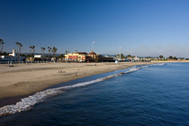
Day 26: Ventura to Manhattan Beach, CA
Cycling Distance: 72 Miles Cumulative Miles: 1,618 Miles Elevation Gain: 1,315' Cumulative Elevation Gain: 58,742' Lodging: CCC Motel Seahorse Inn ($69 plus tax) |
Day 26 Route Guide
Past Oxnard, more hugging the coastline. Views are great but traffic and winds can be a nuisance. Traverse beachgoers through Santa Monica and on into Manhattan Beach.. |
Manhattan Beach, CA to Mexico Border
155 Miles/2,773' Elevation Gain Cycling solo October 6-8 |
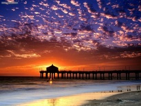
Day 27: Manhattan Beach to Dana Point, CA
Cycling Distance: 60 Miles Cumulative Miles: 1,678 Miles Elevation Gain: 863' Cumulative Elevation Gain: 59,605' Lodging: Dana Point Marina Inn (Free!!) |
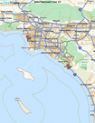
Day 27 Route Guide
Riding solo again, I'll wind through city streets in Torrance, Carson, & Long Beach. Back on the Pacific, it's, likely to still be crazy in Huntington & Newport Beaches. Laguna Beach is a great stop to unwind before rolling into Dana Point. |
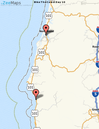
Day 28: Dana Point to Solana Beach, CA
Cycling Distance: 46 Miles Cumulative Miles: 1,724 Miles Elevation Gain: 889' Cumulative Elevation Gain: 60,494' Lodging: Holiday Inn Express ($99.99 + tax) |
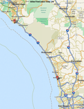
Day 28 Route Guide
It's off to San Clemente then onward to San Diego County, I'll cycle through Camp Pendleton, where the Seals train, then through my high school town of Encinitas. Last overnight in Solana Beach, near Del Mar Racetrack. |
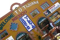
Day 29: Solana Beach to Tijuana, Mexico
Cycling Distance: 45 Miles Cumulative Miles: 1,769 Miles Elevation Gain: 1,011' Cumulative Elevation Gain: 61,504' Lodging: Trolley to San Diego Airport, then Home |
Day 29 Route Guide
Del Mar, La Jolla, Pacific Beach, downtown San Diego and Coronado make for a great home stretch to the border. Cycle down the Silver Strand, then it's a short ride to the border & viva Mexico! |
